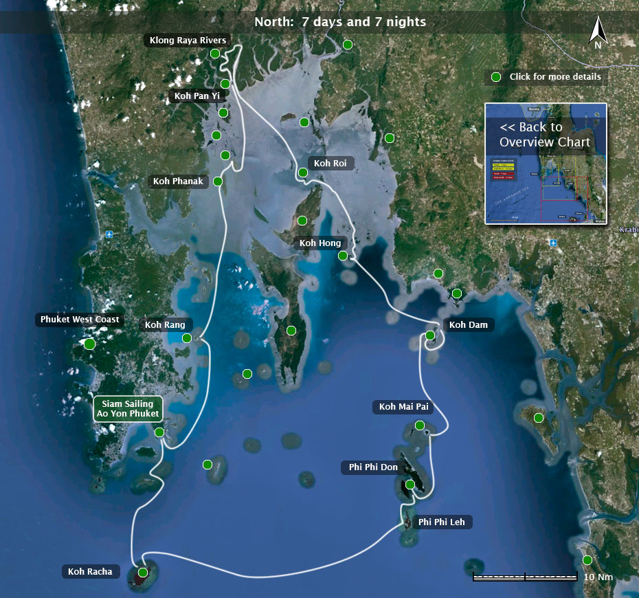


07.48 N 98.23 E
Ao Yon, where Siam Sailings has it's operations, is a true little hidden gem of a place, conveniently located at Phuket's South East extremity.
Well away from the hustle and bustle of the island's tourist area's , Ao Yon is a tranquil small bay offering very good protection in both the North East and the South West seasons. We have a lovely 1 1/2 km semi- private sandy palm fringed beach which you will often have completely to yourself. Swimming, also for children, is totally safe. There are absolutely no dangerous currents, high waves or nasty animals.
Ao Yon's beach provides convenient all–tide access to the boats.

Two characterful wood & bamboo beach restaurants serve delicious food (Thai & European) as well as very cold beer, cocktails and a grand selection of other drinks. All that at very reasonable rates. Cheap (air-conditioned) beach bungalow accommodation is available in Ao Yon itself. More upmarket hotels can be found nearby.
You will find Ao Yon a perfect place to start and finish your charter.
07.41 N 98.45 E
The Phi Phi Islands lie 24 miles east of Phuket.
The group consists of two main islands, Phi Phi Don and Phi Phi Leh plus a few outlying smaller ones such as Koh Yung ("Mosquito" Island) and Koh Mai Pai (Bamboo Island).
Only Phi Phi Don has permanent habitation. Phi Phi Village lies on the isthmus between Tonsai Bay to the south and Lodlum bay to the north. In addition there are several resorts, mainly on the east side. The Phi Phi Islands offer spectacular scenery on land as well as clear water and abundant coral. Excellent shelter for yachts anchoring can be found year round. Boats able to take the ground (like our Wharram catamarans) have an even wider choice: the beach off Phi Phi village, the SE side of Tonsai bay and also the beach in the famed Maya Bay on Phi Phi Leh all have soft sand, are well protected and are free of obstacles.
The waters around Phi Phi offer excellent diving and snorkelling. There are coral reef, wreck and cave dives. The many dive operators and dive schools on the island are mostly run in a safe and professional way and half or full day trips can be booked, usually the day or evening before.
Facilities: Provisions, fuel and water (the latter at a steep price though) are all available on Phi Phi Don in Tonsai Bay. There are twice daily ferry connections with Phuket, Ao Nang and Ko Lanta.
08.20 N 098.30 E
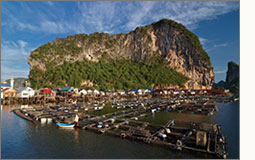 Often erroneously referred to as "Sea Gypsy Village".
Only inhabited island in the Pang Nga Bay. There is a village which is entirely built on stilts in the water. One can dine out here and limited provisions are available.
Excellent overnight anchorage with protection from all winds and excellent holding. The rivers beyond Koh Pan Yi are navigable for a shallow draught boat which can take the ground and offer brilliant scenery and excellent opportunities for exploring.
Just north of Koh Pan Yi there are two caves with prehistoric cave drawings. The caves themselves are difficult to access but the drawings can be seen from a boat.
08.10 N 098.29 E
Uninhabited, steep, densely forested island which is riddled with dry caves, sea caves and "hongs". Most of he caves and hongs can safely be explored on foot or by kayak although it is in some cases wise to check the tide tables before setting off. Unless you'd enjoy a night in a cave waiting for the tide to drop so you can get out again, that is.
All around the island it is deep enough to bring the yacht to within touching distance, you do need to take care not to tangle the rig in the many stalactites that hang over the shoreside cliffs though! Koh Phanak offers, especially in the SW season, several safe anchorages with stunning scenery. It is part of the Koh Hong National Park.
08.12 N 098.37 E
One of the most beautiful anchorages in Pang Nga bay! Small, horseshoe shaped, uninhabited island with a lovely petite beach and an easily accessible hong which is dry at low tide and floods at high water.
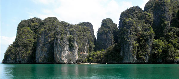
Suitable in the NE season, but not really in the SW season.
In the caves high up in the cliffs nestle colonies of giant fruit bats. At sundown they leave their homes in large droves to forage on the mainland. An awesome sight.
Other than by yachts Koh Roi is rarely visited.
08.21 N 98.30 E
Two rivers in the Pang Nga Bay Delta, which give those yachts with a shallow draught the opportunity to make a fascinating 8 mile river circuit through the mangrove forests.
The scenery is splendid: a vast green carpet of mangrove with here and there huge solitary limestone formations rising dramatically skywards. The forest has hundreds of creeks, in the limestone rocks you can find caves, if you look for them.
About halfway there is a large through-the-mountain tunnel and a pool. An excellent place to enjoy lunch. Which you will have to make yourself as there are no facilities.
The route is a circuit, so you end up at Koh Pan Yi again.
08.03 N 98.41 E
A cluster of some thirty small islands plus a few larger ones. None have permanent habitation.
The islands are high, steep and densely forested so the scenery is splendid. Many of the small islands have inviting beaches but anchoring is often difficult as it is deep until right close in.A multihull can be nosed on the beach for a brief stop in these cases.
The largest island of the group, Koh Hong East, has a spectacular near-landlocked lagoon which is not to be missed. Its only acess to the sea is through a narrow opening in the towering cliffs which surround it. If the tide is right you can (just) take the yacht inside otherwise you use a dinghy or kayak or you swim.
07.48 N 98.97 E

Two islands just south from Rai Leh.
Pretty, with lovely beaches and clear water. The two islands are connected by a sand bank which dries at mid and low tide leaving a pristine pearly white beach. On one of the two islands there is a small resort, so you can dine out. No further facilities. Moorings on the E side and anchoring both E and W and between the islands.
Koh Poda is nicknamed "Chicken Island", on the photograph you can see why.
07.49 N 98.47 E
Two small islands just to the North of the Phi Phi islands.
Koh Mai Pai means "Bamboo Island" which is strange as whilst it is covered in casuari trees there is not a sprig of bamboo to be found. Koh Mai Pai is low-lying has a whiter-then–white beach all around the island as well as a splendid coral reef which offers very good snorkeling. Best snorkeling is on Hin Klang, a submerged reef ½ mile to the SW. The island is a nice stopover for the day , as a night anchorage only in settled conditions during the NE season.
Koh Yung lies 2 miles to the W. The name means "Mosquito Island" which is useful beause it helps keeping the number of tourists down. There are no more or fewer mosquitos on Ko Yung then elsewhere. Ko Yung is certainly pretty but not really suitable for overnight stops as it is a bit deep all around for anchoring and the beach too rocky for beaching.
07. 36N 098 .21 E
Twin islands, Koh Racha Yai and Koh Racha Noi, surrounded by clear blue waters, which shaped the characteristic boulder rock formations.
They are separated by 5 miles. Koh Racha Yai lies some twelve miles south from Phuket which makes it an ideal day sail or a last night's anchorage at the end of a charter before returning to base in the morning. Koh Racha Yai is inhabited, Koh Racha Noi is not (except from some wild goats that live there). Koh Racha Yai has two anchorages, one of each is suitable for either season, on the beach and inland you find various restaurants for dining out.
Koh Racha Noi has a really nice and quiet anchorage on the E side which offers good protection in the SW season. There are small beaches to explore.
Snorkelling and fishing are both good around the Racha islands. Their beauty and proximity to Phuket make them a a natural destination for day trips from Phuket. During the day time especially Racha Yai can be rather busy. From late in the afternoon onwards until the next morning a few yachts and the odd fishing vessel will be the only boats in sight.
08.01 N 098.48 E
Ao Nang (meaning Nang Bay) is a good stop if you are in need of a top up of your provisions. Excellent dining out and nice sandy beaches too.
There is a twice daily ferry to Phuket and road connections with Phuket are good too. Krabi town is 20 minutes by bus.
Ao Nang is not a suitable anchorage in the SW season.
08.00 N 98.50 E
World famous beauty spot.
Ray Leh Beach is only accessible from the sea due to the high cliffs that surround it on three sides. South side offers excellent protection in NE season, the East side is amply adequate in the SW period.
Many restaurants and beach bars. Limited provisions available from mini markets. A cave features an animist shrine. A trek into the hills bring you to pools in the jungle.
Ray Leh Beach is famous for rock climbing, several climbing schools offer courses from beginner to expert.
08.08 N 098.38 E
Smaller sister island to the north of the long island Koh Yao Yai.
A little bit, but only a little bit more developed. The island has several very pretty beaches and is definitely uncrowded. The waters surrounding it are usually not very clear, so not the best for snorkeling. It is more mountainous then it's larger sister. Especially near the North and the North East tip there are some spectacular rock formations.
Koh Yao Noi is quickly gaining a reputation as favoured destination for rock climbers and mountain bikers. Anchorages and creeks where one can beach a boat safely abound. The channel between Koh Yao Yai and Koh Yao Noi is easily and safely navigated for shallow draught boats. Along both the East and West coasts one finds here and there eco–style resorts for dining out. From the E side: fantastic views over the Koh Hong Krabi archipellago.
There is limited shopping in the main village, water and fuel are obtainable near the ferry pier (several daily small local ferryboats to Phuket).
08.00 N 098.35 E
Largest island East of Phuket in the area. Koh Yao Yai has been spared excessive development, there are a few eco–style resorts but no mass tourism. Despite being situated close to Phuket one can easily find empty beaches with splendid views.
Virtually all of the west side can be used as an overnight anchorage in the NE season, likewise the entire East side is good in the SW season.
Other then several beautiful beaches Ko Yao Yai has no really outstanding points of beauty or interest but if you seek solitude you will find it here.
One can find some small restaurants and limited shopping at Ao Labu, the largest bay on the west side. At the south tip there is a bay in which a river flows. On a rising tide you can take the boat to the small village a mile or so upstream.
07.56 N 98.17 E
The W coast of Phuket has some fifteen anchorages suitable for overnight stays. That is: in the NE season only, the entire coast turns into a nasty lee shore with high waves during the SW season.
Those seeking solitude and quiet will discover that idyllic anchorages and empty beaches are somewhat rare in this area. Those who enjoy a night out ashore and who like to enjoy watching life on the beach go by from the comfortable vantage point of their yacht will find it perfect.
Yachts planning to sail to the Similan islands are wise to spend the night before the 55 mile crossing on Phuket's West coast so they can make landfall in the Similans by daylight.
Meals ashore can be had everywhere and provisions can always be bought nearby.
A few favorites: Nai Harn & Ao Sein is a popular anchorage for cruising yachts. Ao Nui just to the north is pretty and, for Phuket, totally uncrowded but very small. Kata Noi is a very popular beach and If you fancy a night out Kata is a bit more civilized then Patong. Patong is ideal for the die-hard night crawler or for those who aspire to become one. In addition: excellent for provisioning too.
What are perhaps Phuket most beautiful beaches are found north of Patong, Surin beach and Bang Tao. A series of upmarket resorts are found here.
08.16 N 98.37 E
Very scenic island, some four miles long. High, thickly forested cliffs with small secluded beaches in between.
Separated by a fairly narrow channel from the mainland. As the mainland also has high steep cliffs it feels like sailing through a canyon when one sails through the channel.
Koh Chang Lat and nearby Koh Khlui are both uninhabited, save for some temporary shelters built by fishermen.
On the SE side of the channel there is a bay (almost drying out at low tide except for a small channel): Laem Sak with a village of the same name. At each end of the bay there is an interesting cave with prehistoric drawings. One can have a simple meal in Laem Sak village, or a little further on there is a fantastic logal seafood restaurant (ask for "Raan Ahaan Talay").
08.14 N 98.30 E
A.k.a "James Bond Island". Famous as the backdrop of a scene of the James Bond film "The Man With The Golden Gun".

Visited by many tourists daily. There is nothing to remind you of the film.
08.18 N 98.29 E
The channel between Ko Raya Ring and the South side of Ko Thalu Nok offers excellent shelter for all winds. Both islands are uninhabited.

Ko Thalu Nok is completely honey combed with caves, creeks, hongs and lagoons and is brilliant for exploring by kayak.
08.32 N 098.29 E
Uninhabited small island, 2 miles NE of Koh Panak. Excellent overnight anchorage in both seasons. "Hong" means room in Thai language and denotes a lagoon. There is one and a very pretty one it is too.

If you want (and the tide is right) you can anchor inside the island, in the lagoon itself. A rather magical experience in a rather magical place. Best time to explore the lagoon is just after sunrise, the early morning light is beautiful. Or go just before sunset with a kayak (it is best to have the tide at mid tide).
In addition to the lagoon there are several small sea caves. There is lots of wild life such as hornbills, crab eating monkeys, eagles, kingfishers, etc.
08.22 N 98.41 E
Small 5 mile long river.
Difficult to find and difficult to navigate with several nasty underwater obstacles. Shallow draught yacht which can take the ground is essential. Not for the inexperienced.
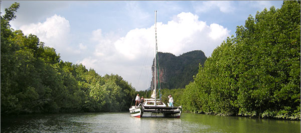
Phenomenal number of splendid caves, creeks, hongs, so nirvana for kayak exploring. Uncrowded. One cave with prehistoric drawings.
Floating restaurant about halfway up the river.
08.13 N 98.43 E
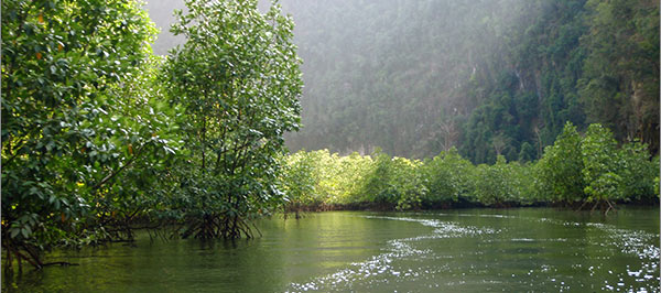
Fjord-like river, about 6 miles long at the foot of a large rockformation on the one side and a mangrove forest on the other. No habitation.
At it's head is a very attractive pool. A perfect anchorage in glorious surroundings, well off the beaten track.
Wildlife abounds. Hornbills, monkeys, brahimi kites, king fishers and also gibbons are frequently spotted.
07.49 N 98.58 E
The island is pretty but not exceptionally so. The beaches are nice but not outstanding.
So there must be a reason to go there. There is: the food. Koh Pu, aka Ko Jum for some unknown reason boasts a number of restaurants of exceptionally high quality for exceptionally low prices.
Decide between (French) Mediterranean or Thai, climb up the eighty or so steps from the beach to boost your appetite and enjoy.
07 .39 N 99.39 E
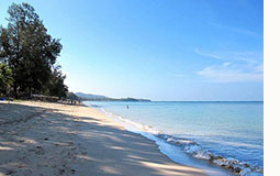 Koh Lanta's main and best known attractions are the long sandy beaches on it's west coast. Naturally, over the years many resorts have sprung up and in some places the tourist industry is quite developed although it is in no way over crowded.
In the NE season a yacht can safely anchor just about anywhere along the W coast, particularly in the four or five bays to be found there. Beaching is possible with care as some beaches have scattered rocks.
Koh Lanta is just about the best place in the entire sailing area for topping up your provisions. The somewhat ramshackle boomtown of Saladan on the NW tip has shops not only selling local produce but also niceties like proper bread, wine, cheese etc. Water and fuel can be topped up in Lanta as well.
The channel between Koh Lanta Yai and Koh Lanta Noi can easily be traversed on a rising tide. The E coast is much less frequently visited but certainly holds its attractions. The charming old capital of the island, Talad Yai has some lovely houses and (good) restaurants built on stilts in the water, water and fuel and provisions can be found here as well. About a mile to the E lies a group of islands, Koh Poh, Koh Bubu and Koh Kam. Peaceful, quiet and lovely. Lanta's E coast can be visited year round, the W coast beaches are a lee shore in the SW season.
07.45N 98.28 E
Attractive small island lying only 6 miles from our base, so an ideal destination for a day sail or as a last night's stop before returning to Ao Yon in the morning. Other then the guards of an abandoned resort the island is uninhabited.
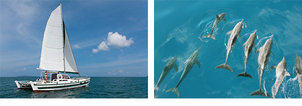
Particularly the SE section offers good snorkeling and a pretty beach. Fishing around Ko Maiton is good too. There is a semi resident school of dolphins near Koh Maia Ton which, if they are so disposed, can be quite tame.
07.57 N 97.25 E
Twin islands just E of the Phuket coast, pleasant anchorages offering good shelter in both seasons. Perfect for a lunch stop. Quite good snorkeling.
A lovely long sandy beach on the W side of Koh Rang Yai (the biggest of the two islands). There is also a pearl farm (in a floating pearl cage) and a (day time) restaurant. During the day, the island gets some day-trip visitors. Good holding on the NE of the island in the SW season.
Ko Rang Noi, the smaller island to the NE of Koh Rang Yai, has a small pleasant beach.
07.54 N 097.30 E
Two small groups of islets a short distance from each other. Stunningly beautiful beaches but often sadly rather crowded with day trippers from Phuket.
Shelter is quite marginal so only really suitable for short stops.